
Irrigation software
Mock up irrigation systems on every property you service
FieldMapr is irrigation mockup software built for contractors who map sprinklers on satellite imagery. Heads, valves, and zones live on the service site — with inspections and branded PDFs in the same workspace.
As-built maps and inspections are live today. This is not irrigation design CAD.
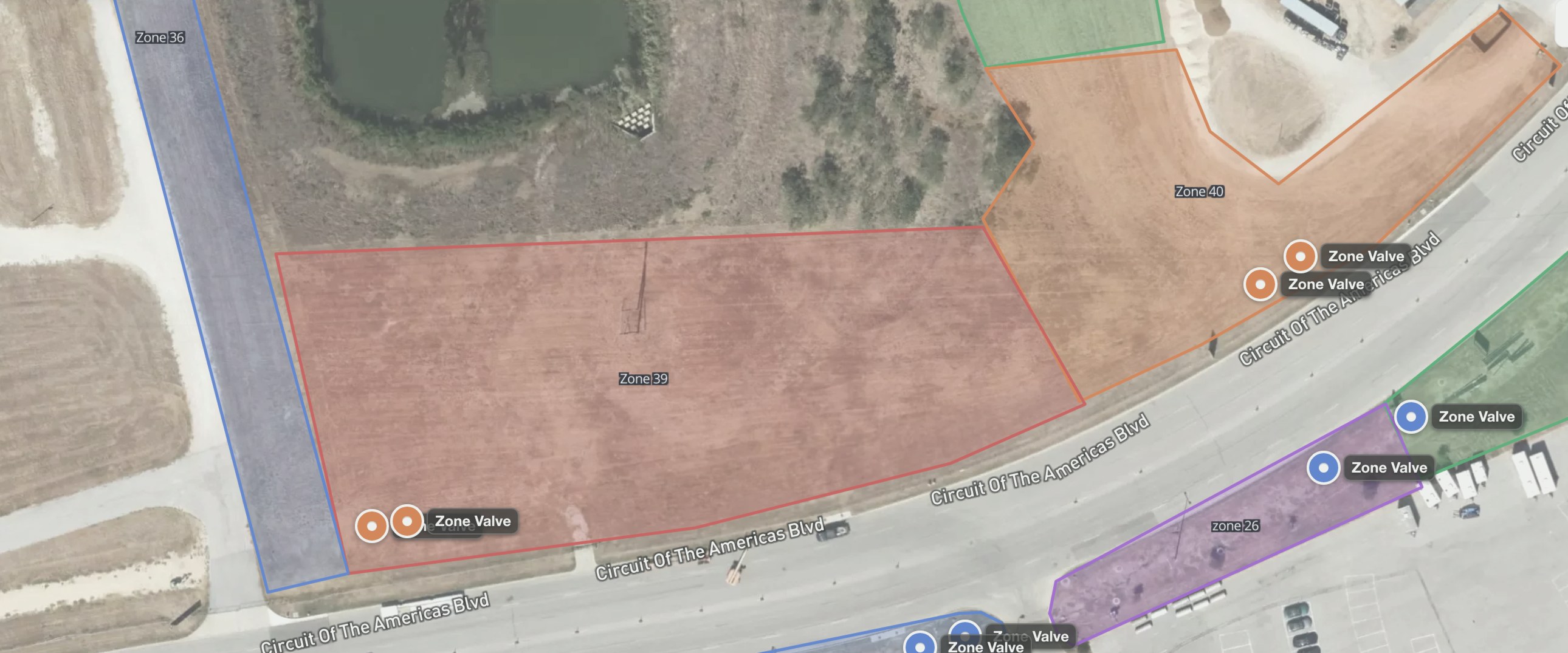
COTA
ActiveZones · valves
© Mapbox © Maxar
Stop reconstructing systems from memory
Paper sketches and one tech's notebook disappear when they leave. FieldMapr puts the irrigation layout on the property so the next truck can see heads, valves, and zones before anyone steps out. Keep Jobber or Housecall Pro for billing if that is where the office already runs.
Know every system you service
Heads, valves, wire runs, and zones live on the map — not in one tech's notebook or memory.
Inspections tied to the property
Document what you find in the field digitally, linked to the customer and service site it belongs to.
Schedule the work that follows
Turn findings into dispatched jobs with a shared calendar and board — so the office and trucks stay aligned.
From property to map
- 1
Add customer and property
The account you bill and the service site you walk — separate records, linked together.
- 2
Mock up the system on satellite
Open live imagery for the address and place heads, valves, zones, pipe, and wire where they sit.
- 3
Inspect on the same site
Run digital checklists, notes, and photos on that property — not a clipboard that never becomes a report.
- 4
Export PDFs or schedule follow-up
Download a map or inspection report, or turn findings into a job (Beta on Team and Pro).
Two jobs on the same site
Map the system, then inspect it
Satellite mapping
Mock up the sprinkler layout on live imagery. Place heads, valves, zones, pipe, and wire where they sit on the lot.
- Live satellite for the service address
- View/Edit so techs can review without accidental changes
- PDF map export for the truck or the customer
Digital inspections
Run checklists, notes, and photos on that same property, then preview a branded report before you send it.
- Startups, backflow, and seasonal workflows
- Live PDF preview on paid plans
- History stays with the site, not a clipboard
What's live today
Irrigation mapping
Mock up heads, valves, and zones on satellite imagery tied to the customer and property.
Explore →Inspection reports
Digital checklists on the same site, then a branded PDF with live preview.
Explore →- Satellite maps with heads, valves, zones, pipe, and wire
- Irrigation mockups on the actual property, not a blank drawing
- Digital inspections tied to the same service site
- Branded PDF maps and inspection reports on paid plans
- Customers and properties kept separate
- Jobs & dispatch in Beta on Team and Pro
- Fielden summaries you review before anything goes to a customer
- Keep Jobber or Housecall Pro if that's where you bill
Built for irrigation crews
Irrigation contractors
Document systems across commercial and residential sites with maps and reports your crew can reuse season after season.
Solo operators
Run the whole workflow yourself — customer records, mapping, inspections, and PDF delivery — without juggling spreadsheets and paper forms.
Small irrigation companies
Give your team a shared workspace for properties, maps, jobs, and inspection history so work doesn't get lost between trucks.
Field technicians
Map systems and complete inspections on a phone or tablet in the yard, with everything tied back to the right property.
Frequently asked questions
Honest answers for irrigation contractors evaluating FieldMapr.
- What is irrigation mockup software?
- Irrigation mockup software lets you show a sprinkler system on the actual property — usually on satellite imagery — so the crew can see heads, zones, and valves before they walk the yard. FieldMapr does that as irrigation mapping on live satellite, tied to the customer and service site.
- Is FieldMapr irrigation design CAD?
- No. FieldMapr is field documentation: as-built maps, inspections, and PDFs. It is not hydraulic design software and does not replace RainCAD, IrriCAD, or similar design tools.
- Can I run inspections in the same app as the map?
- Yes. Maps and inspections attach to the same property. Complete checklists in the field, then preview a branded PDF report before you send it.
- Do I have to replace Jobber or Housecall Pro?
- No. Keep your CRM for scheduling and billing. FieldMapr is the map, inspection, and PDF layer on each service site.
- What software do irrigation contractors use to map sprinkler systems?
- Irrigation contractors use irrigation mapping software such as FieldMapr to place heads, valves, zones, pipe, and wire on live satellite imagery of the property. The map stays on the customer's service site with inspections and branded PDF reports, so any tech on the crew can find equipment before walking the yard.
- Is FieldMapr sprinkler as-built software or design CAD?
- As-built. FieldMapr documents the sprinkler system that is already in the ground — maps, inspections, and PDFs on each property. It is not hydraulic design CAD and does not replace RainCAD, IrriCAD, or similar design tools.
Map your next property today
Free to start. No credit card required to sign up.
Same FieldMapr workspace if you also hang lights — maps and inspections stay purpose-built for irrigation. holiday lighting software.